Exploring
4Labels: lift a POI onto the roof of the building it stands on (mapbox symbol-z-elevate)
POIs sit at ground level even when they belong to a building that is drawn 30 m tall. At tilt, the icon and its name float in front of the facade instead of standing on t…
Facade API: a six-verb ABI over the SDK, with events and a C binding for RN / NativeScript / WASM
The SDK exposes 495 Java proxy classes across 221 SWIG modules, and every capability is an object you construct and wire by hand. That buys two things worth keeping — obj…
Custom layer interface: let an app draw into the map's 3D scene without forking the SDK
Apps want to draw their own content inside the map — a proprietary mesh renderer, a heatmap, particles, an AR overlay, a custom data visualisation — positioned in the map…
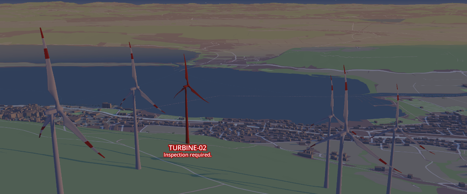
3D models: draw GLB meshes from a data source, styled in CartoCSS
Place glTF/GLB 3D models from any data source — a GeoJSON file, an MVT layer — and style them in CartoCSS, the way markers and buildings already are. Many instances per t…
Shipped
2feat(terrain): reach the horizon when zoomed out, and render flat when 3D buys nothing
Symptom Zoomed out with 3D terrain (z8-9 and below), the ground ends in a disc well inside the screen instead of reaching the horizon. Cause: the absolute view distance i…
3D buildings: soft edges, ambient occlusion, real facade lighting, roof shapes
Our 3D buildings read as flat, pasted-on blocks with hard 90° edges next to Mapbox GL JS's. Close the gap: contact ambient occlusion on the ground, bevelled edges, a per-…
Rebuilt nightly from GitHub. Browse the issues directly → Sponsoring changes the order — see Sponsors.