Navigation Maneuver Arrows
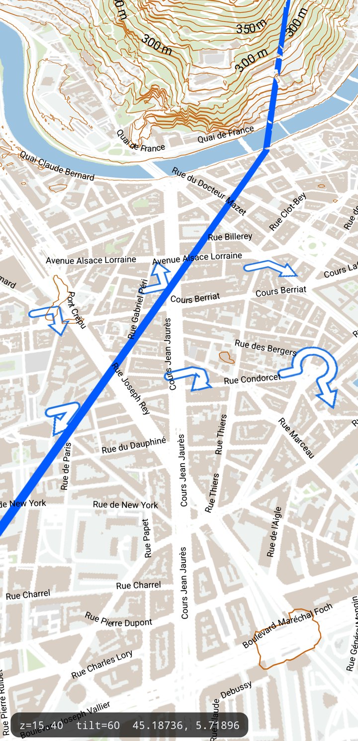
The turn arrow a navigation app draws on the route: ManeuverArrowBuilder cuts the piece of the
route around a maneuver, and the head is a line property — no marker, no bitmap, no second
symbol layer.
Added in PR #61. The reference is
maplibre-navigation-ios, which slices the
route the same way but draws the head as a symbol. Technical notes:
docs/internals/rendering/15-maneuver-arrows.md.
Building the geometry
ManeuverArrowBuilder builder = new ManeuverArrowBuilder();
builder.setLengthBefore(30f);   // metres walked back along the route
builder.setLengthAfter(30f);    // metres walked forward

// from a RoutingInstruction's point index …
FeatureCollection arrow = builder.buildArrowAtIndex(null, routePoints, instruction.getPointIndex());
// … or from a position on the route
FeatureCollection arrow2 = builder.buildArrow(null, routePoints, maneuverPos);
It returns a FeatureCollection in WGS84 holding one line, running the way the driver goes,
clamped at the ends of the route. Pass a Projection if the points are not WGS84 (null = WGS84).
The walk is done in an equirectangular plane anchored at the maneuver's latitude — exact at the tens
of metres an arrow spans.
Serving it is ordinary SDK API; there is no maneuver-specific data source:
GeoJSONVectorTileDataSource source = new GeoJSONVectorTileDataSource(0, 24);
int layer = source.createLayer("maneuver");
source.setLayerFeatureCollection(layer, null, arrow);
setLayerFeatureCollection replaces the whole layer, so an app showing several arrows (the current
maneuver and the next) keeps its own id → collection map and rebuilds from it.
With the surface API
ManeuverArrowBuilder has no spec type — it produces geometry rather than being a map object — but
the source that serves the arrow does, so only the builder itself stays object-API:
MassifSource arrows = map.source("maneuver-src", Spec.of("geojson").set("maxZoom", 24));
int layer = arrows.createLayer("maneuver");
// The builder returns SDK geometry, so the object-API setter is the one that takes it directly.
((GeoJSONVectorTileDataSource) Massif.rawSource("maneuver-src"))
    .setLayerFeatureCollection(layer, null, arrow);

map.addLayer("maneuver", Spec.of("vector")
    .set("source", "maneuver-src")
    .set("style", "route-style"));
Styling contract
Two rules, four attachments, no assets:
#maneuver::case     { line-color: @casing; line-width: linear([view::zoom], (12, 3.9), (17, 13));
                      line-join: round; line-cap: round; }
#maneuver::fill     { line-color: @fill;   line-width: linear([view::zoom], (12, 2.4), (17, 8));
                      line-join: round; line-cap: round; }
#maneuver::headcase { line-color: @casing; line-width: linear([view::zoom], (12, 3.9), (17, 13));
                      line-end-arrow: true; line-arrow-only: true;
                      line-arrow-width: 2.18; line-arrow-length: 1.72; }
#maneuver::head     { line-color: @fill;   line-width: linear([view::zoom], (12, 2.4), (17, 8));
                      line-end-arrow: true; line-arrow-only: true;
                      line-arrow-width: 2.4; line-arrow-length: 1.9; }
- Whole shaft first, head over it. An attachment is drawn at the position of its first rule,
hence four of them.
line-arrow-onlydraws the head alone, so the shaft runs its full length underneath, and the head's base carries a slot one line width wide so nothing of it crosses the shaft. - The casing's arrow numbers are smaller than the fill's, and that is not a typo. They are read against its own, wider line; repeating the fill's numbers draws a border round the head ~1.7× the one along the shaft.
- One knob drives the whole arrow. The widths interpolate over
[view::zoom]— the live camera zoom, re-evaluated per frame — and the head is a multiple of the width, so shaft, head and border shrink together and the arrow never swallows the junction.
A custom head
line-arrow-path takes the d attribute of an SVG path (M/L/H/V/C/S, Z, absolute or relative,
curves flattened) and fits it into the arrow box, so a contour lifted from an icon set works whatever
its viewBox. Both rules carry the same path, and the casing shrinks its box by fill / casing.
line-arrow-scale and line-arrow-rotation finish the placement.
The shape must be convex — a shape with lobes folds its border where they meet, and the SDK logs a warning rather than silently redrawing it.
Where it lands in the draw order
| Wiring | Result |
|---|---|
A VectorTileLayer of its own over the GeoJSON source | draws over every layer below it, under every Marker / Label / popup (billboards are one global pass after all layers). Works with any style. |
CompositeVectorTileLayer.addVectorDataSource("maneuver", source) | the arrow lands at the maneuver slot of the base style's layer order — over the roads, under the labels. The production wiring; the two rules must live in the style. |
With the composite wiring the route line itself should move into a tile source too, or the arrow
(inside the base layer) ends up under a route drawn as a VectorLayer. And within a vector tile
layer, labels draw after that layer's geometry —
setLabelRenderOrder(VECTOR_TILE_RENDER_ORDER_LAST) moves every base-map label above the arrow.
Why not a marker for the head
A rotated marker-file symbol was built first (it is what maplibre does) and every one of these had
to be fought: marker-fill does not tint a bitmap (marker-color does), a two-colour head can not
be tinted at all, each part needs its own attachment for draw order, the shaft's cap showed through
the head, and with marker-clip: true the head is baked into the per-tile terrain drape texture and
cut in half at every tile edge it overhangs. The line property has none of these: one geometry, one
style layer, one draw order, no bitmap.
See also
- GeoJSON Vector Tiling — the source that serves the arrow.
- Routing — where the maneuvers come from.